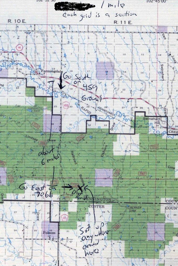
Directions and Map for the Buffalo Gap National Grasslands observing site.
Go SE of Rapid City on Highway 44 past Caputa and onward about 1 mile past
Farmingdale to County Road 459.
At the turnoff there is a service station on the north side of the road, and
a street
sign on the south side of the road for 160th Avenue (with "459" in smaller
numerals
underneath). TURN SOUTH onto the gravel road. The coordinates, for
GPS owners,
should be 43.9537N, 102.8585W.
Go south on C459 about 6.5 miles where you will find a double gate, marked
for a dirt road, number 7066, with two tracks going east, one north of a fence,
and
one south of the fence. Use the track on the north side of the fence.
The coordinates should be about 43.8677N, 102.8533W.
Take the road 7066 going EAST about one mile following the fence until the fence
ends, then go east
about
one more mile and set up on the top of a hill.
7066 is a rough dirt trail
which is
borderline for a car and easy with a higher
clearance 4-wheel drive or AWD.
If the road is muddy you will need 4-wheel drive or AWD.
You should plan on arriving before it gets dark.